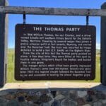
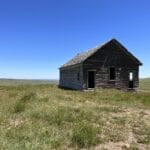
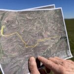
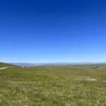
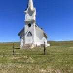
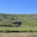
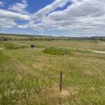
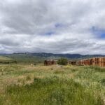
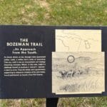
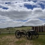
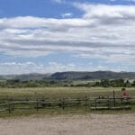
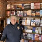
This is the entire Bozeman report. As I receive new updates, I will add them.
The Bozeman Trail
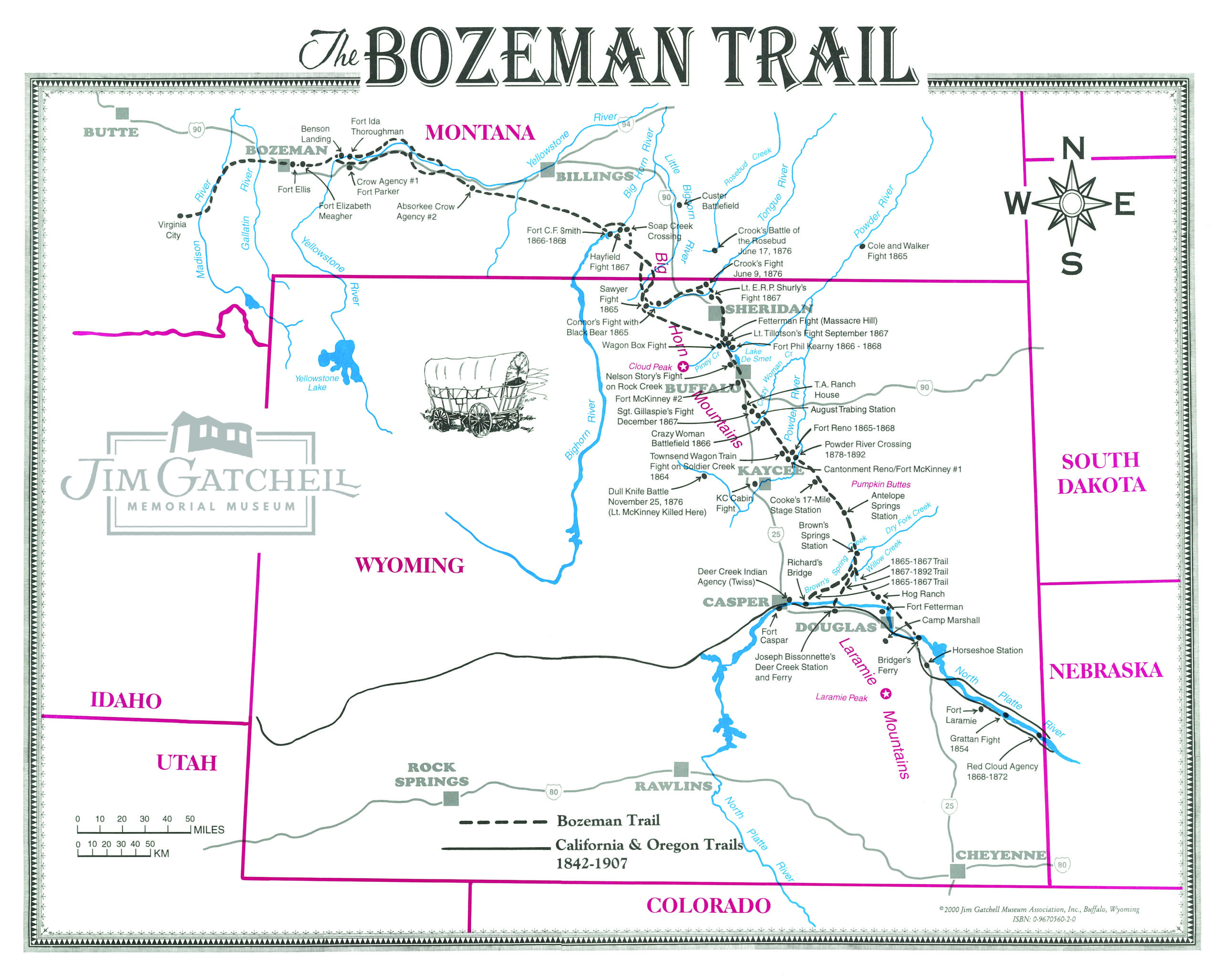
Early on we realized that the Bozeman Trail ran through all 5 counties. It was quickly apparent this is a project that would bring tourism to the smalltowns. If a place is a nice place to visit, it’s a nice place to live. People who move to small towns no longer move for jobs. They are moving for quality of life. Providing recreation like trails, biking, riding, racing and walking can happen along the Bozeman Trail. That’s one of the kinds of quality of life people look for.
Take a moment and imagine this scenario.
The people headed west got up at daybreak, and began the day. They ate breakfast about an hour later. Lunch was around 2. While they ate, the cattle grazed until 4. Some wagon trains had a good 700 head of cattle. After 4, they hit the trail again until the sun went down. 20 miles traversed was a good day!
The Bozeman Trail was used for only 4 years. At times it was a small track and at other times it was a huge corridor, both running across the vast expanse of south central Montana. Ralph Saunders has committed a lot of time and effort following the Susan Doyle diaries, written by the travelers themselves, to make the most accurate map. Howard Boggus, a Crow historian, has walked the trail and follows the history of the Crow and other native nations to create his mapping. Most of the time, both maps are almost the same. Other times, there is a wider difference.
Steve Simonson, an economic developer and volunteer on the project said, “I believe both Ralph and Howard are right!
While the wagon camp sites and landmarks can be documented in the journals known to us through the Susan Doyle book, “The journey to the land of gold”, it’s by no means the only source of information.
Howard’s people used parts of this route since the ice age began receding along the Eastenr slope of the Rockies some 12,000 years ago. I have no doubt that early travelers to our area such as Jim Bridger used the well established corridor that had been used by native peoples as documented in his recent book, authored by Enzler.
Freighters traveling along this corridor would have found easier routes that were perhaps faster, going back empty to resupply near Glenrock Wyoming. An alternative route when fully loaded that may have been slower, but an easier grade to climb would also make sense. This gives additional credibility to Howard’s route that as far as I know is the only known person to have walked the entire route in recent times. Howard’s route along the tree line in certain places is logical from a feed, and forge as well as a personal protection standpoint. Gullies aren’t near as deep along tree lines as further down the valleys for wagons to cross.
Again both Ralph and Howard are right.”
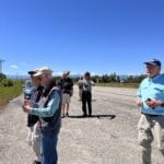
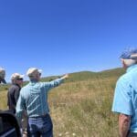
In picture above: Howard Boggus, Deb Brown, Emma the Intern, Ralph Saunders, Mike Simonson
This is exciting for the Trail Project! By using both maps, we have more access to public lands and the small towns that have grown along the trail. We’ve said all along we want to NOT travel on private lands, and be respectful to those owners. I, like most of the team, believe we should design the route to be used for tourism and economic development purposes on public lands. We can follow some county and state roads as well.
Steve brought up this question at our last gathering. “So while documenting precisely where the diaries go along the trail, it’s the corridor that’s more important to me. Is a 10 mile corridor acceptable to our group? Could existing pullouts or Fort Smith be developed by the Crow Tribe and State park’s system? That’s where I’d like to see our efforts go.”
Mike Penfold, Deb Brown, Ralph Saunders, Steve Simonson
Ralph Saunders shared this snippet about his research methodology with me.
A Location Study of the Bozeman Trail
Research Methodology, and a Segment by Segment description of trail location by Ralph Saunders 2022
Bozeman Trail location Methodology
Introduction
This author has recently partaken in the efforts toward making the John Bozeman Trail a National Historic Trail. The endeavor is warranted, but my only involvement has been in helping to determine the actual location of the trail. I am doing this along with Mike Penfold, Ross Waples, and Dr. Lucas Ward. It is well known that the trail changed locations over the short number of years it was used, but this study is focused on the Sawyers cutoff trail from the Bighorn River to where it connects up with the Bridger/Bozeman trail, near Joliet, Montana, and from there to Virginia City. Future studies of other locations of the trail will be decided by the Bozeman Trail Board.
This study is in the works and the primary report has been written. Ralph will make the full report available upon completion.
A few ideas that can be tried in the future:
A group that moves across 5 counties could be chaotic. However, that’s the beauty of the Bozeman Trail Project. Anyone who wants to do something is encouraged to go ahead and try.
When we first started many ideas were shared on how to utilize the Bozeman Trail in our counties. These were:
- Could there not be a driving tour trail?
- River crossing in Joliet and fits in with Dave Engels (Engels Coach Shop cries for attention.
- Some suggestions from the Utah State long-distance cycling routes: economic impacts, best practices, and marketing strategies report:
- Develop trails that promote multi-day trips.
- Monitor route use through trail counters and surveys.
- Connect cycling routes to local shops and grocery stores.
- Market attractions near the cycling route.
- Create and complete assessment tools to establish route readiness.
What could many day trips be? Places who are doing this kind of work include:A couple of examples include the
- Blues Festival in Ritzville, WA - they have camping at Fairgrounds, 4H kids feed folks with breakfast. There are overnights with music and food.
- RAGBRAI is a bike ride that goes across Iowa every year.
Other possible trail ideas:
- What are the county roads that followed the Indian trails?
- Reach out to Wyoming folks for detailed maps for their area
- Might be funding through the mine grant funding - $5000 without going through committee
- Stillwater County has lots of funding too
- Think about the route of Columbus to Red Lodge.
- Guided horseback rides
- What did it take to get a wagon across a river? “A Day in the Life” along the trail.
- Tribal experiential opportunities
- Leveraging other events such as Jim Bridger Days in Bridger, county fairs, county-wide garage sales, rodeos, Absarokee BBQ Days .
- Podcasts / self-guided tours – a phone app
- Eventually, along with local Audubon chapters, we might be able to develop a Bozeman Birding Trail.
- Create trailhead pocket parks in each community where the trail passes through. These parks could include a kiosk with maps to the trail and/or downtown, seating, wifi, bike racks, fix-it station, water fountain, etc. Could include EV Charging stations.
For 2023 Steve mentioned trying to prepare for the Space to Place Grant. The next steps could include:
Discussion about Is the map we’re developing the best one to use?
Ask the BRCD Board if the grant could be pursued.
Determine the best location. Different steps for permissions depending on where the sign(s) are located.
Gathering public support. In Laurel: presentations to service clubs, eagle scout project? City Council if located in Riverside Park. Others?
Could we do two signs if a MT Tourism grant was successful? Best location?
Cost estimates by (Fall 2022). Get a current estimate(s). Are we in the ballpark cost wise?
Apply for Space2Place grant February 2023
https://www.bigskyeconomicdevelopment.org/community-development/space2place/
Bozeman Trail Project - A brief synopsis on what the team has done
How it all began:
Steve Simonson knew Mike Penfold was working on the Wyoming side of the Bozeman Trail Association. Mike’s group was going through all the rigmarole required by the government to get a feasibility study done and then get the trail on the historic national designation. While we definitely support their work, we knew that this process could take years.
So how could we use the Idea Friendly Method to get started on the Bozeman Trail Project in Montana?
Gather Your Crowd
We began gathering our crowd, putting together lists of people in the five Montana counties who might be interested in helping Mike, but also doing projects in the area. The list was pretty long! By February of 2021 we had 12 folks on board from museums, city and state office workers, historical re-enactors, researchers, Crow people and retired folks.
We started hosting zoom calls to meet each other to talk about the possibilities to support Mike but also branch off with Idea Friendly projects. Those early calls brought to light that a reliable map was necessary. Before any county could create projects, they needed to know where the trail ran through their areas. Penny had a makeshift map in her museum that was a good starting point.
These calls were much fun to participate in. There were stories, suggestions and ideas shared on each one. Because we had no deadlines, we could focus on building community around the Bozeman Trail Project. We weren’t involved in this project to be efficient. We were here to build projects around the Bozeman Trail that brings our 5 counties together. And shares the history of this part of Montana.
It became quickly apparent that working with this group, most of whom were over the age of 60, was going to take some time. We weren’t slowed down, but we were concerned with accuracy around the stories of the trail and the places where the trail actually ran.
Take Small Steps
The Zoom calls happened about every month during 2021. Some of the action steps taken early on were:
- Mike Penfold shared his videos and photos
- Several people worked on access points in each county
- We began the logo discussion
- Started planning what to do in May when I visited
- We wrote support letters for Mike
- Began posting on social media and sharing with others about this group
We realized that the logo discussions weren’t necessary this early in the process, so we tabled that. Social media posting was done sporadically until Myrna said she’d make sure it was posted on the Beartooth RC&D Facebook page regularly.
Build Connections
Patrick Cross from the Absaroka-Beartooth Wilderness Foundation joined the group in March of 2021 He also brought GIS capabilities with him. This began the mapping portion of the project. Many discussions on what needed to be on the map(s). Several of the group worked on their regions and began bringing more information to the team. Ralph Saunders, local trail mapping expert, Lucas Ward, Professor at Rocky State University have come together to involve Luke’s students and make this map the most accurate ever done. There is funding for their work from Beartooth RC&D remaining funds from the grant that brought Deb here. In April, Brendan Wiltshire from Columbus joined the mapmakers. He’s the GIS person hired in Stillwater County. A group of us met in person at Rocky Mountain College in October with Dr. Luke. These professionals went to work with their sleeves rolled up and began the planning process of mapmaking. Dr. Luke will bring in students to participate in the project.
Olivia Rose Williamson, local Crow artist and storyteller of the Battle of Little Big Horn from the viewpoint of the Crow, joined the process. Several of us participated in her AirBnB experience. She told this story via Zoom in April 2021 and enthralled us all.
The Joliet Beautification Committee expressed interest in this project, and they continue to work on including it in their plans and actions. Work continued on the research for the map as well.
Small Steps Continue to Grow
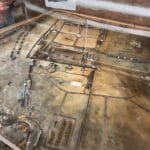
In May of 2021 Deb came to town and visits were made. Rose gave an in-person tour of the Hayfield Battle area. That was followed up by a visit to a local landowner’s property to see his land where he believes the trail came through. A group of us went to the historical museum that Penny is responsible for and spent a chunk of time in the map room. Ralph and Mike were so much fun to watch! They truly enjoyed themselves buried up to their elbows in maps. A visit to Howard Boggus, Crow historian, happened. Howard has a basement full of Crow history, including much about the Bozeman Trail. Howard has also walked the entire trail and knows it well. There was also discussion beginning around the topic of grants.
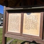
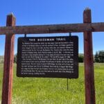
June brought discussions of signage. Mike said they have started to identify key interpretive sites along the Trail where the public could view these locations. Several people stepped up to research the signs already in use for the Bozeman Trail.
July 11th a group visited Bill Yellowtails land, landowner in Big Horn County. Imagining yourself on the trail while standing on the actual trail helped to energize the team.
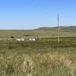
Dave said some areas where the ruts are profound
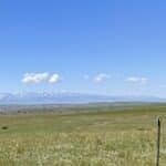
and clearly seen. Being on the trail, looking at the big sky in Montana and
seeing for miles and miles is an experience all enjoyed.
Signage conversations happened too. Steve and Dave began a list of possible places for signs. We’ve got an inventory listing from the DOT. The DAR has signage up, markers for Hayfield and brown and white signs along the highway.
Bill told an interesting family story where the Sioux came, and the Crow were outnumbered and finally chased them down and killed them all – this site was right on the Bozeman Trail. He also talked about the vision quests and sweats and other great info. Capturing these stories became one of the new goals for the Bozeman Trail.
A mural project in Joliet was discussed and is still being pursued. Everyone is doing a little something, taking small steps.
In October of 2021 Deb made another visit to Montana. She videotaped Howard telling some stories, Steve Simonson and Mike Penfold sharing talk of the Bozeman Trail and Doc Woerner telling stories. Doc took her on a ride around and visited rural areas on the reservation and also a buffalo ranch. You can see all of those videos at https://studio.youtube.com/channel/UCAWDdODbb0w5KTmDxNDWokw
By the end of the last quarter of 2021, The Bozeman Trail Project gave us plenty of ideas with action being taken. Various small groups of people began projects around the big idea of creating attention to the Bozeman Trail in Montana.
Stephanie Ray in Columbus is working with locals to paint the street for Absarokee Days in summer. The trail runs right through town.
Raymond Porter from Big Timber is exploring ideas for Big Timber and building a small group. There are hot springs along the trail, John Bozeman was killed in this area, and Greycliff is on the trail. Raymond fixed the Google listing that says synagogue Bozeman trail.
A group from Joliet made up of the former mayor, current mayor and some biz owners who want to beautify main street make up this group. There’s a Bozeman trail river crossing and a piece of land the city owns that could have a kiosk. They will clean up that area first. The chuck wagon on the main road could be a great story. They decorated it. Planning for what information to provide is happening.A mural on the side of Jane Dough's Pizza building has been proposed. The group is developing this idea.
Steve and Dianne from Billings are looking at Coulson Park as a signage location, maybe a kiosk too. There is Big Sky EDA funding for placemaking, and they will pursue this idea. Blue Creek fishing access site is another crossing for Indians and the trail people probably camped there. The dogs scared the oxen! The Bureau of Land Management has a park where Clarks Forks comes in. Rim Rocks has the spot where Lewis and Clark crossed with the horses.
Mike Penfold wanted someone to speak at the Wyoming legislature, so Myrna did so. Mike presented in Red Lodge at the Historical Museum. Mike spoke in Billings at a group called the Westerns and found new enthusiasts.
There are other people doing things as well. Some are walking the trail and others are doing research. Our museum people have created displays, answered a ton of questions and go along on some of the in real visits.
Zoom call in March of 2022.
Good news! We have a great idea of where the trail is. Ralph Saunders said, “I’ve enjoyed every bit of this - it might be keeping me alive.” This is just another reason we wanted to do the Bozeman Project. Because it matters to so many people that are involved. It’s not a team of muckety mucks telling others what to do. It’s a team of anyone who wants to be involved. And it’s powerful work.
2024 is the 160th anniversary of the Bozeman Trail. We could have events in several places tied together with wagon rides or trail rides and end up in a town with craft sales, dance, etc. Each community would plan their own events on a certain day. We could do it over a week in the 5 counties. Several people are working on making this a reality.
We talked about adding new people to the group. It’s set up so folks can come and go, participate as little or as much as they wish to. Mike mentioned Harlan (someone) who would be a good fit. I like that we remain open and invite anyone who wants to join in!
This project has involved many people of varying ages and different cultures working together. We are telling stories from history, using natural resources and bringing people together. We were able to start with what we had and grow from there.
Read the story of the Bloody Bozeman Highway here: https://sheridanmedia.com/news/local/94909/the-bloody-bozeman-highway-to-the-gold-fields/
Reaching out to the politicians
I sent this letter to Senator Tester’s aid:
Dear Sir,
I’ve had the pleasure of working with 5 counties in SE Montana for the past two years. Beartooth RC&D was awarded a grant and I was asked to come and work with the small towns. One project that has developed is the Bozeman Trail Project. It runs through all five counties: Yellowstone, Carbon, Sweet Grass, Sweetwater and Big Horn.
I am writing to formally request legislation to direct the Secretary of Interior to conduct a Feasibility and Suitability Study for designation of the Bozeman Trail in Montana and Wyoming as a National Historic Trail, pursuant to the National Trails Act of 1968, as amended.
Results of the study will provide additional information on recreation opportunities and economic benefits for these small towns with a focus on along the Interstate travel corridor which parallels the historic trail route.
I have attached a briefing paper that succinctly lays out what the Trail is and the benefits of your actions in supporting a feasibility study. Also attached is my reporting on the work done for the last 2 years on our Bozeman Trail Project in Montana.
Dylan, thank you for reviewing this email and attachments and getting it in front of Senator Tester.
This was the response I got from Erik in that office:
Thanks for reaching out. I removed Dylan to streamline his inbox until we need him. It looks like you’ve done a lot of work since Mike and I last talked. There were some shenanigans during the last Montana Legislature that were a bit unnecessary, but that’s how things seem to go these days. I’m glad to see that didn’t take the wind out of your sails.
In our last talk, Mike and I had some discussions surrounding how proponents might successfully navigate the legislative process. With the makeup of the Senate, legislation would need to be bipartisan to move forward and in this case, Senator Barasso is the Ranking Member on the Senate Energy and Natural Resources Committee. Additionally, Senator Daines is a member of ENR. There’s a fair amount of consideration to be made on who introduces legislation and when, but I haven’t heard how any other office feels about the trail. Mike can describe his interactions and the legislation I mentioned. It was signed into law by our Governor, so it’s probably important to know where he stands. Although it’s not likely a state law like that could prevent anything in Congress, it can certainly create issues.
I’m looping my colleague Henry who shares the portfolio with me. He’s on leave through the recess, so he may not have input until he returns. I’d be happy to talk more and elaborate.
Thanks,
Erik
I’ve asked Steve Simonson and Mike Penfold if they would like to continue the followup in this case. Mike is very active with getting the feasibility study done via Congress already.
Lastly
My 2 year contract is over. We have completed some portions of the Bozeman Trail Project with more to go. There are other parts not completed. And that’s okay. Remember, we are building community and not a time schedule. There are resources following. I will include more of Ralph’s work,once it is ready for publication. Luke and his team will also have updated maps. I’ll be adding them to www.BuildingPossibility.com/Bozeman as I get them.
Thank you for the opportunity to work on this project.
Deb Brown
Resources
Video Links
We’ve got plenty of videos for those who are interested in pursuing more information.
-
- Video link of a wagon trail Mike Penfold & Co. sponsored over the trail, most of which was shot within Beartooth RC&D’s 5-county region and the Crow Reservation. Bozeman Trail on the tracks
- Montana PBS Bozeman Trail Special: The Bozeman Trail | MontanaPBS
- Mike Penfold interview with R.L. (Ron) Garritson, Historian, Signtalker, adopted into Indian families discussing his family and Bozeman Trail history.: https://www.youtube.com/watch?v=LnIT6HBuSww&t=1623s
- Mike Penfold - Bozeman Trail with slides, telling the stories of the immigrants who used the Bozeman Trail: Bozeman Trail with slides - YouTube
- Kansas State 1-hour Webinar: (Fantastic & well worth the watch!): The Role of Trails in Economic Development" (k-state.edu)
- 1st PPT in webinar: Trails as Economic Development Engines_04.02.21.pdf
- 2nd PPT in webinar: All Trails Lead To Ottawa
- American Trails Webinar Archives (free): Webinar Archive - American Trails
- Videos Deb shot with Mike, Steve, Howard and Doc https://studio.youtube.com/channel/UCAWDdODbb0w5KTmDxNDWokw
Websites
- Indian Country Tourism Region
- National Historic Trails Interpretive Center | Bureau of Land Management (blm.gov)
- National Historic Trails Interpretive Center Official Website
- Rocky Mountain Tribal Leaders Council
- Great info on the Benefits of Trails: https://headwaterseconomics.org/wp-content/uploads/trails-library-overview.pdf
- Trails Benefits Library Archive - Headwaters Economics
- Testimony of land owners: Elizabeth Burger, Sunflower Foundation, sent this report which was given to the Kansas Legislature last year, including great information from landowners. It has some great points that are relevant to MT Trails as well, and it could be helpful for anyone writing a grant application. It is a public document and can be shared with anyone. https://documentcloud.adobe.com/link/track?uri=urn:aaid:scds:US:67daf24c-e17d-4295-b1a9-a5aa07973cb4
- Article: Tourism Could Be an Economic Driver in Indian Country With Focus and Investment
- Heritage Tourism Info
- Yellowstone County - We Call It the Bozeman Trail (rootsweb.com)
- Placemaking Grant & Resources (realtorparty.realtor)
Grants that are available for local groups to do a Bozeman Trail project - many projects will fit the criteria. Contact Holly Moskerintz (Hmoskerintz@nar.realtor) with questions.
Listing of the local Realtor Associations in Montana. You can see which ones are impacted by the trail: https://www.montanarealtors.org/main/local-association-directory/.
Social Media Resources
-
- Yellowstone Country Facebook https://www.facebook.com/YellowstoneCountry (can also just search for Montana’s Yellowstone Country)
- Folks can take a look at the kind of info we put out directly, as well as the kinds of posts we share from partners. I believe we already follow most of the orgs, but I will make sure.
- Yellowstone Country blog site: Top 20 Yellowstone Country Instagram Photos of 2020! | Yellowstone Country, Montana (visityellowstonecountry.com).
- This way everyone can see the types of blogs our social media manager puts out about things to see & do in the YC region. I could definitely see her writing a blog about the trail—that said, we’d probably need to do a road trip before she does so she is very familiar.
- Yellowstone Country Facebook https://www.facebook.com/YellowstoneCountry (can also just search for Montana’s Yellowstone Country)
- Deb Brown / SaveYour.Town:
https://www.facebook.com/BuildingPossibility
https://www.instagram.com/debrainiowa/
- Beartooth RC&D (Resource Conservation & Development)
Beartooth Resource, Conservation, and Development Area, Inc. | Facebook
- Bozeman National Historic Trail
https://www.facebook.com/BozemanNHT
https://www.fortphilkearny.com/bozeman-nht
Videos from Mike Penfold
Coulson Park https://comm7tv.vod.castus.tv/vod/?video=ab6283ca-c616-4ff0-bd93-6fae06c56e00&nav=programs%2FOur%20Montana
Bozeman Trail https://watch.montanapbs.org/video/the-bozeman-trail-qbl0je/
Bozeman Trail Comm 7 https://youtu.be/BrMaKqF7wR8
Fetterman Fight Before the Fight https://youtu.be/nPg3kxdsd7w
Billings Gazette Article https://billingsgazette.com/outdoors/groups-seek-historic-designation-for-bozeman-trail/article_3d23e727-0193-5344-b0a6-45bc40b52ea5.html
The Fetterman Fight - The Fight --https://youtu.be/pOYxKMnFCB0
Bozeman Trail – Fetterman - https://comm7tv.vod.castus.tv/vod/?video=af57df50-77e9-4f9d-a928-5c6ebfbd1b23&nav=programs%2FOur%20Montana
Out of Blue Creek Bozeman Trail - https://comm7tv.vod.castus.tv/vod/?video=788ec4a1-9f96-4a7e-8608-138f95013f51&nav=programs%2FOur%20Montana
Burton Pretty On Top http://www.pryormountains.org/cultural-history/crow-sacred-landscape/
Grant Bull Tail. Heartbreak Hotel https://www.youtube.com/watch?v=WoLhrtVRcuM
Crow Stories https://www.youtube.com/watch?v=8aXJsm5X928
Old Red Woman - https://www.youtube.com/watch?v=UeqnddPWe1o
Garritson youtube https://www.youtube.com/watch?v=LnIT6HBuSww&t=1623s
Garritson Comm 7 https://cloud.castus.tv/vod/#/comm7tv/video/605910db8ca3de0007ec80a0?page=HOME
Bozeman Trail Slide talk taped https://youtu.be/M1fWe51cI_s

